Photography in the Time of Covid 2022
Rich Stolarski
Here we go into 2022. Hopefully this is the year we see Covid fading into a place that it is not dominating everything that we do (like travel.) |
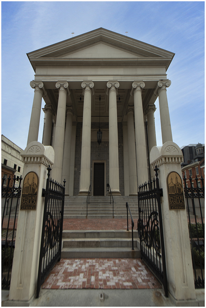
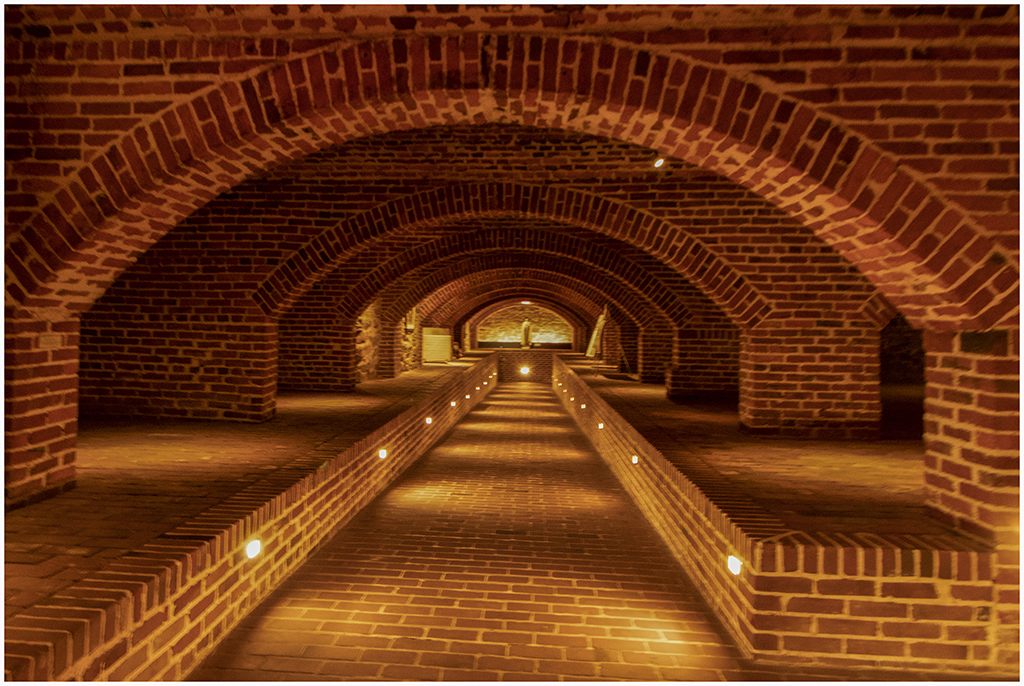
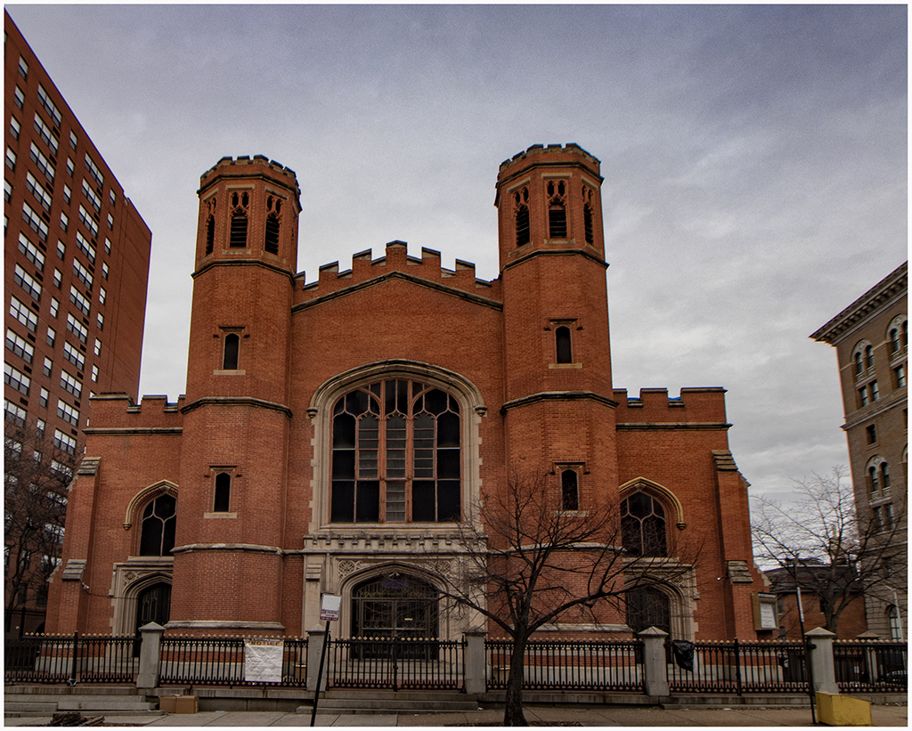
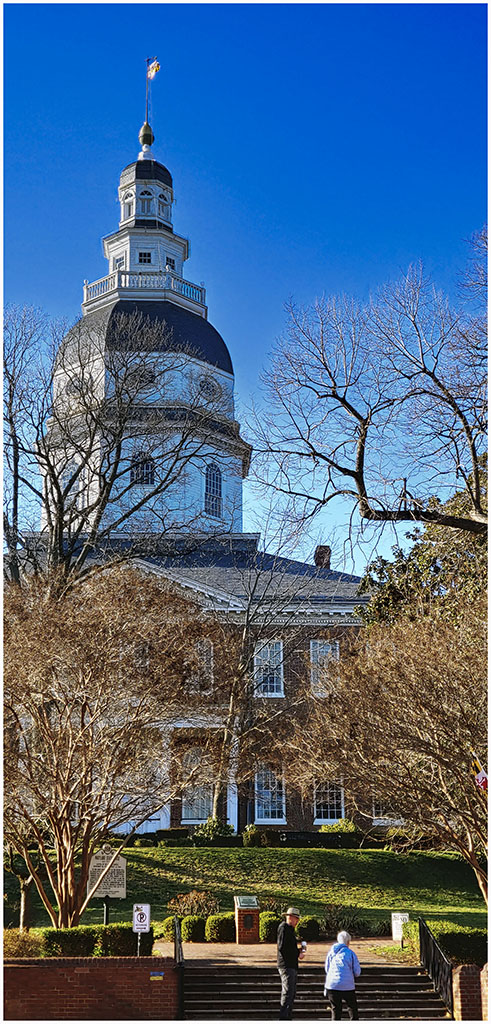
On Saturday January 19 we made our first trip of the year with the Arundel Camera Club to the Baltimore Basilica, the first Catholic Church in the United States. Ed Niehencke of the camera club arranged a private tour with a docent who was very knowledgeable about the history of the cathedral. We learned that the Church was designed by Latrobe under the direction of John Carroll the first Bishop in the United States. He chose a classical Roman Basilica design as opposed to a Gothic Cathedral. The church becomes a basilica when the Pope declares it as a significant building within the Catholic faith. We went down into the lower floor of the basilica to tour the crypt with its curved brick walls. After the tour I took a picture of the First Baptist church on the diagonal corner from the basilica. We had intended to walk down Charles Street to take some pictures of the interesting buildings but the weather was so cold that we decided to go straight home. |
|

|

|

|

|

|

|
|
|
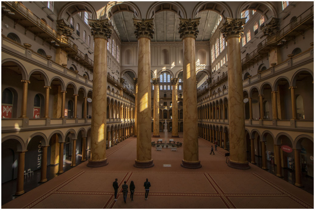
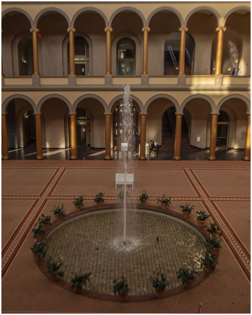
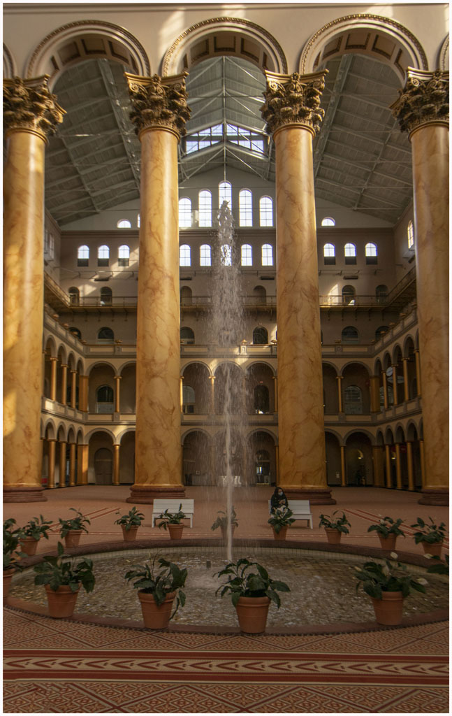
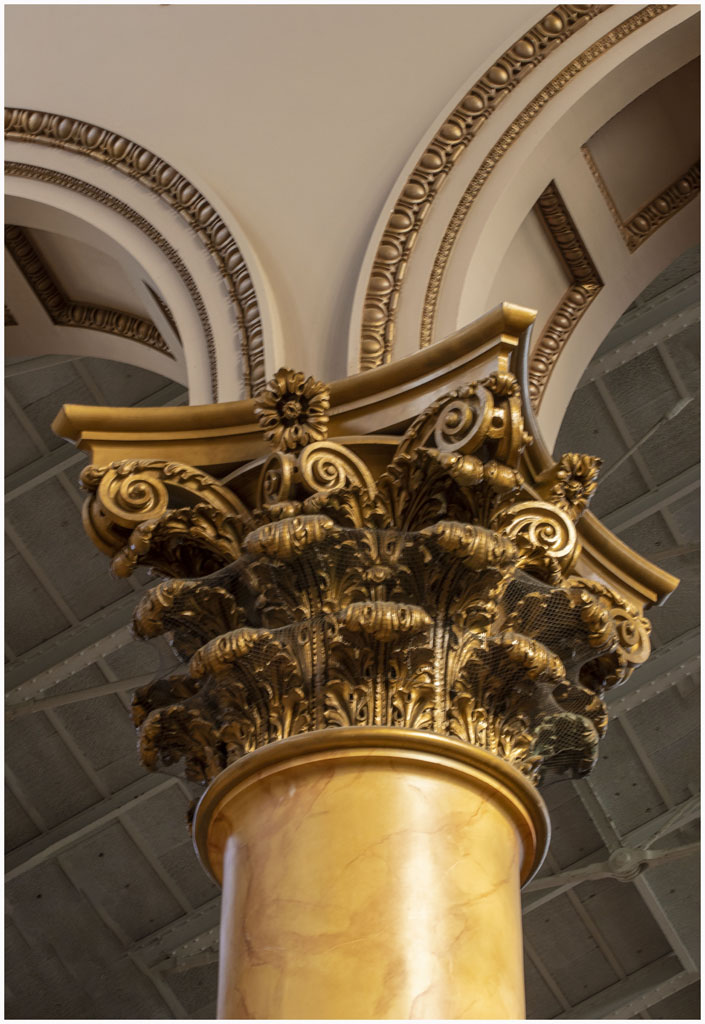
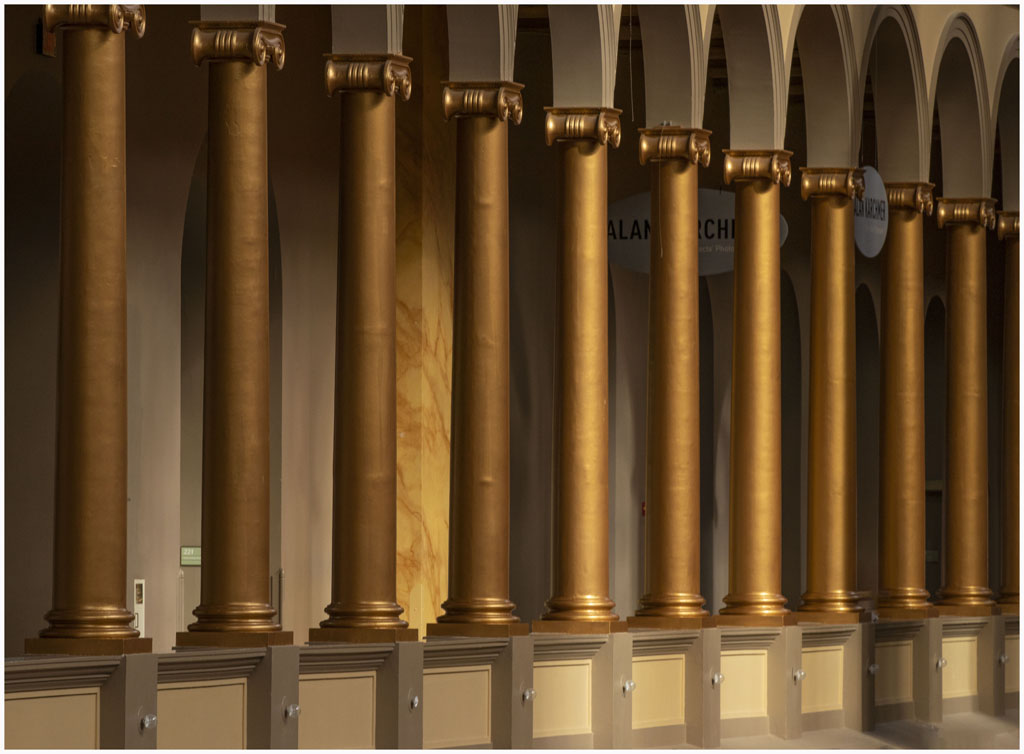
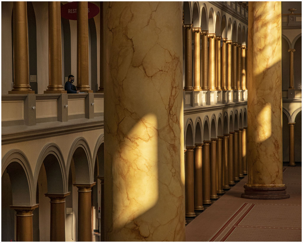
It has been quite cold so far this year, thus discouraging us from getting out as much as in the past. On Saturday February 12 we had an unusually warm day and got on the metro to head to downtown DC to the National Building Museum. I had seen some pictures of the inside of the building that were quite spectacular despite the building being relatively unknown among DC sights. The building certainly lived up to my expectations and I took the photos below. |
|
|
|
|
|
|
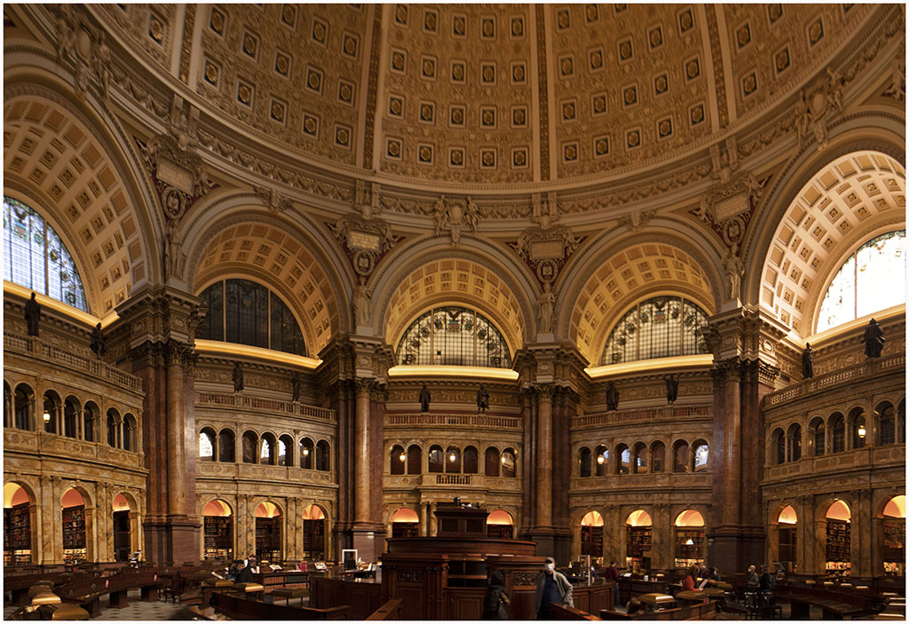
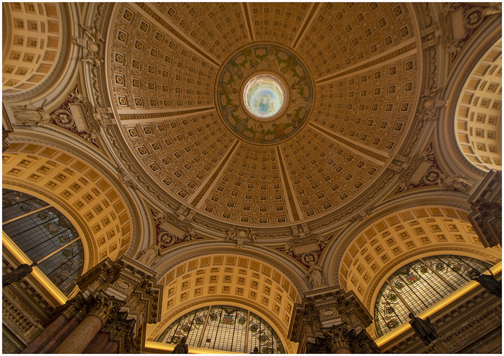
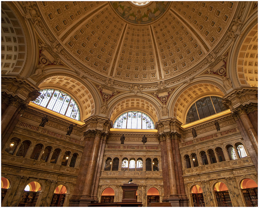
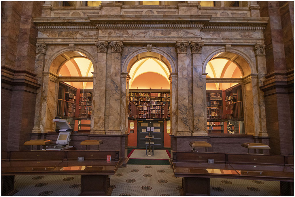
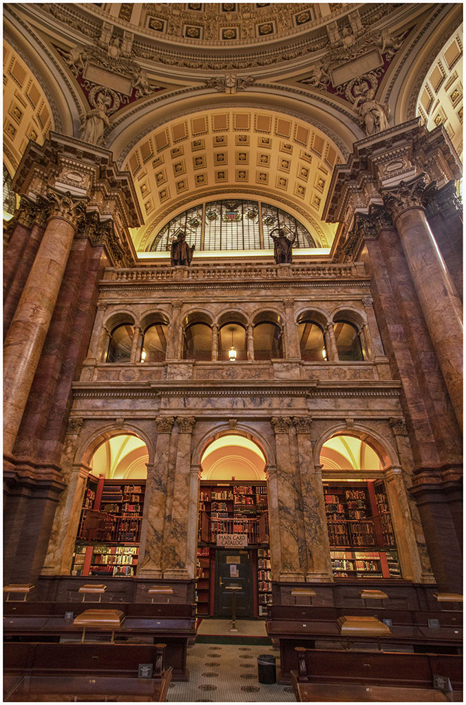
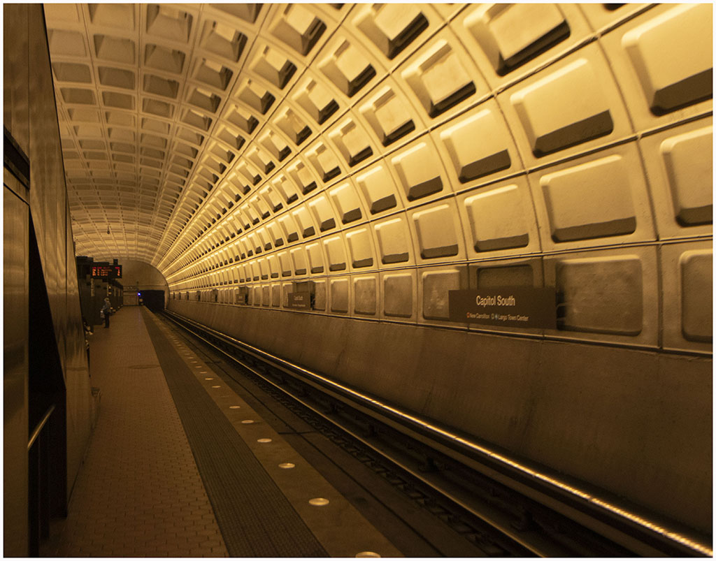
Presidents Day is one of the two days during the year when the Library of Congress opens the main reading room to the public rather than to just researchers. We scheduled an outing for the Arundel Camera Club for that day to take advantage. I went in the early afternoon and spent about an hour in the main reading room taking photos from as many angles as possible. The library is an amazingly photographic building and I found it hard to decide on what would make that iconic photograph so I took lots of photos in nearly every direction. The early afternoon light coming in through the windows made some of the photos a bit difficult. I focused mainly on the main reading room but also took one of the building on my way in and several of the great hall. Finally I took one of the interior of the South Capitol Metro station on my way home. |

|

|
|

|
|
|

|
|
|
|

|

|

|

|
|
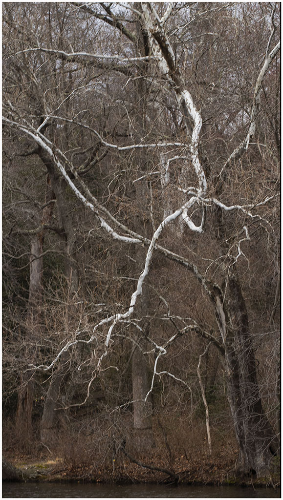
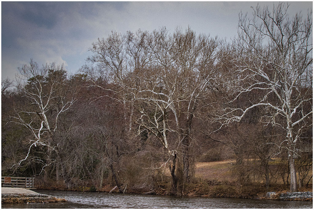
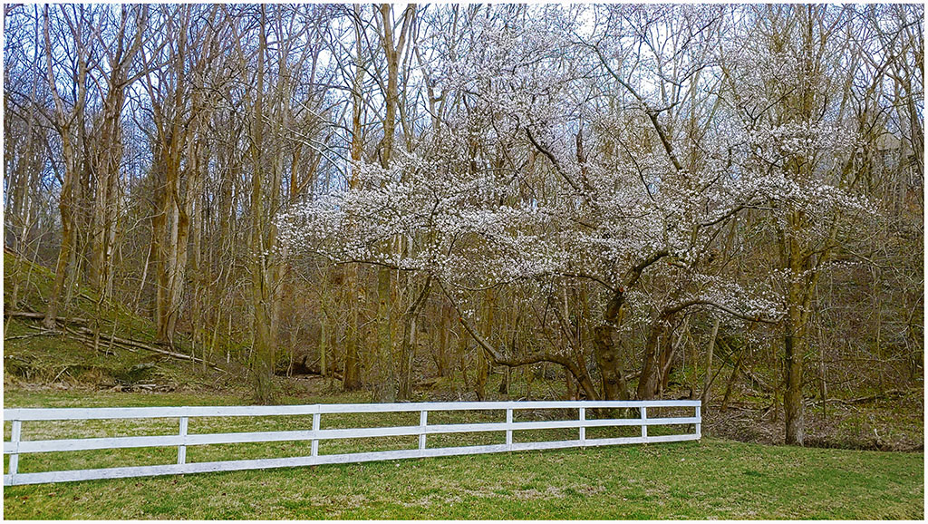
On Sunday March 6 Shirley and I decided to take a short drive to Lake Waterford park for a walk and to take a few pictures. One of the sights that I like and photographed were the white-limbed sycamore trees with their tangled/twisted limbs. |
|
|
|
|

|
|
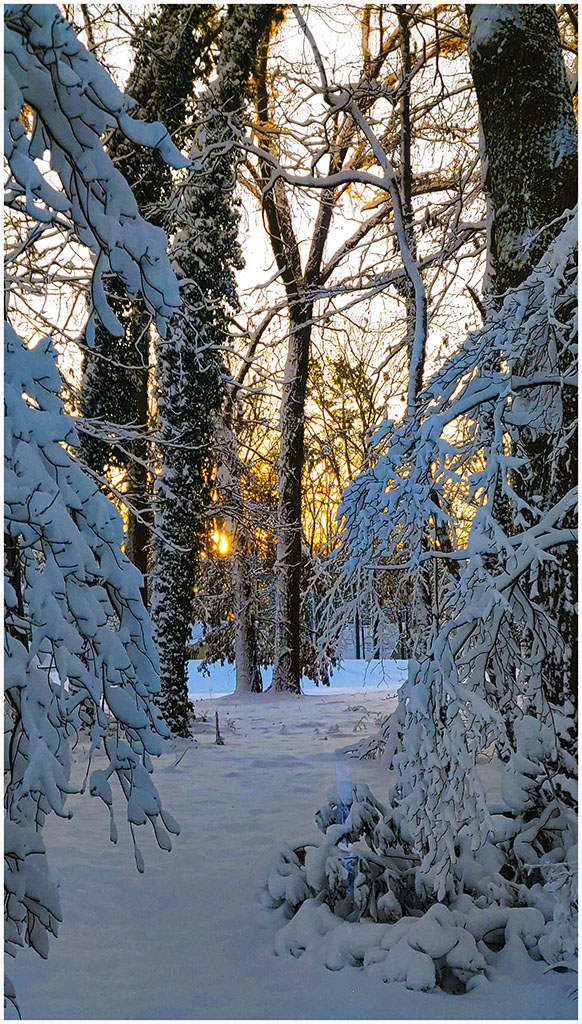
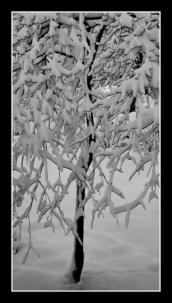
While downloading the pictures from Lake Waterford park I also downloaded the pictures from my phone that went back to some pictures taken during the snowstorm in early January. There are 3 groups of photos below: 1) from our house during the January snow where we had about 6 inches, 2) Annapolis on a very clear afternoon in late February, and 3) near our house in early March. |
Snow in Crofton

|
|
|
Annapolis on a Clear Day in February

|
|
|
|

|
More Crofton

|

|
|
|
|

|
|
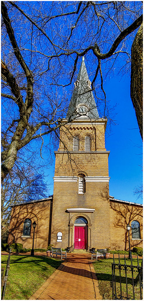
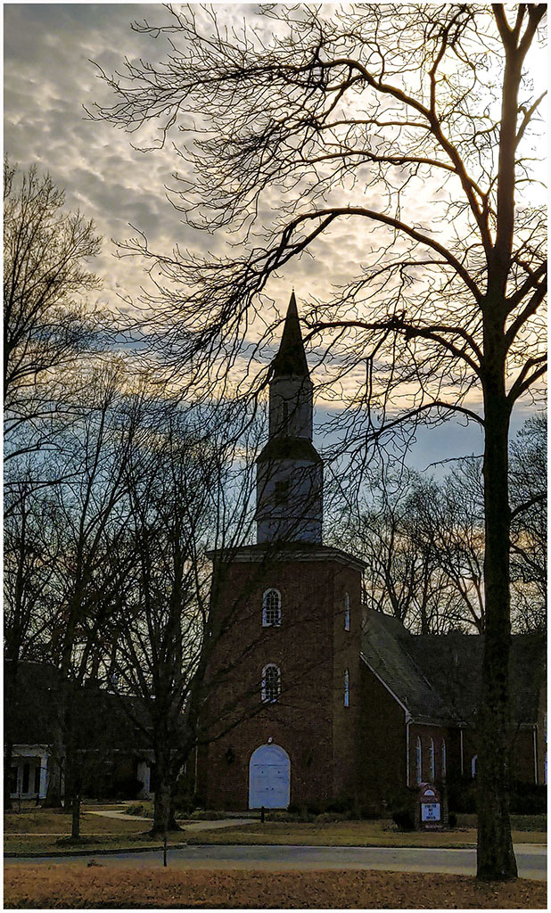
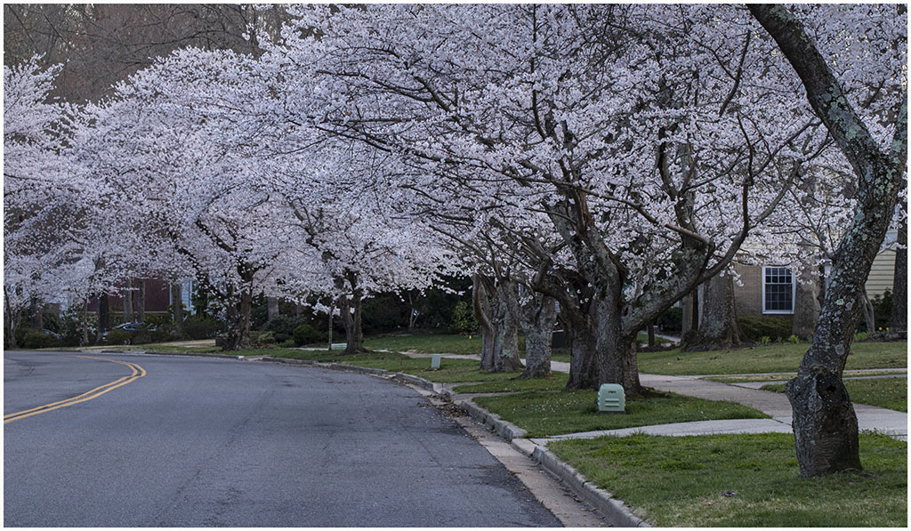
March 25 we began hearing of the cherry blossoms being at their peak in DC. I didn't have the energy to go down and deal with the crowds of people so I drove around Crofton to see our small version without the wonderful background of the monuments in DC. I took one picture of a row of trees on the Crofton Parkway and another of the Baptist Church with a couple of flowering trees in front. |
|

|
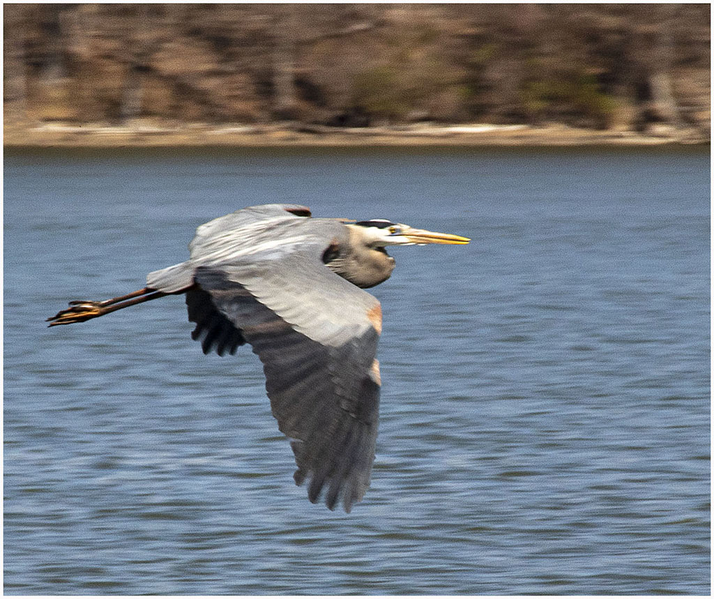
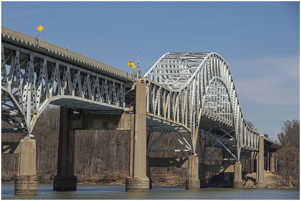
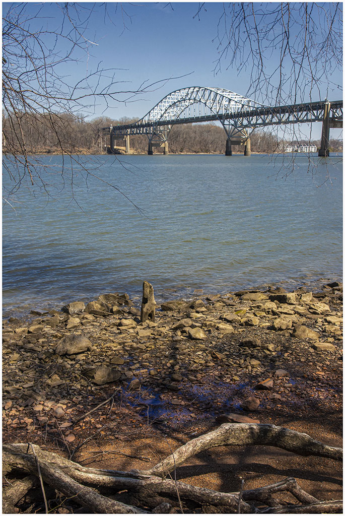
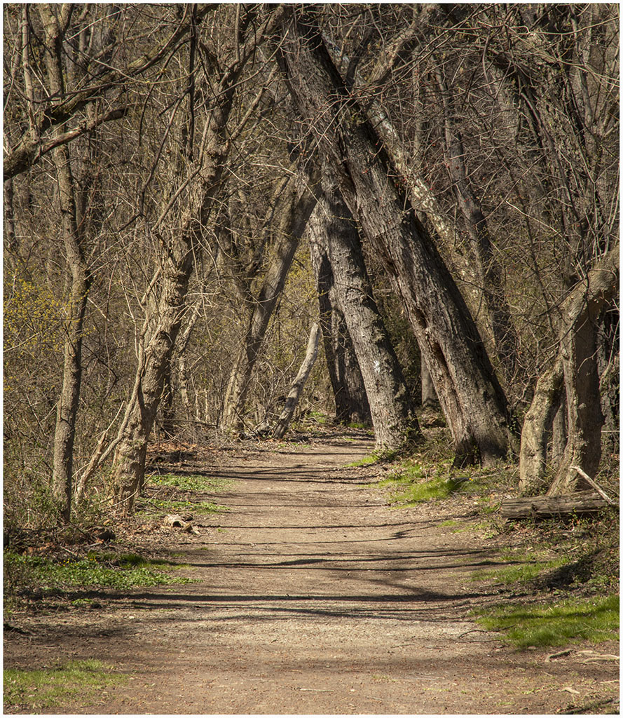
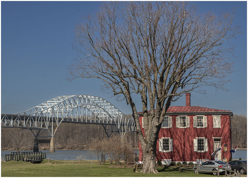
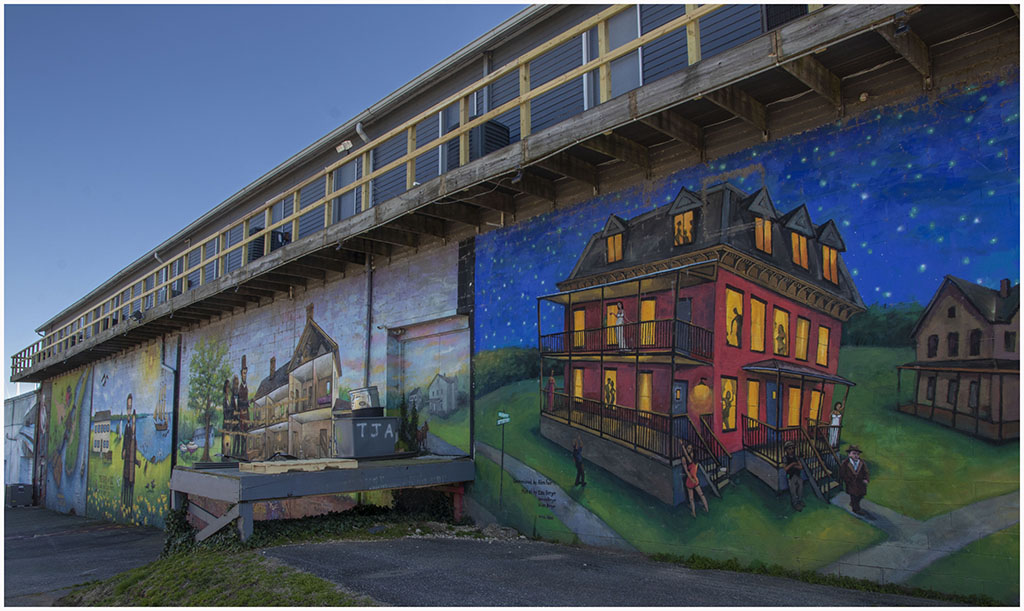
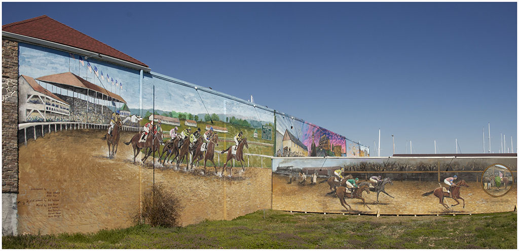
On Saturday April 2 we took a ride up I-95 to Havre de Grace, Maryland. The town
is located where the Susquehanna River empties into the Chesapeake Bay near the top of
the bay. We first stopped at the Lock House Museum and then took the Joe K. trail, advertised
as an easy 1.5 mile loop along the river and back along an abandoned railroad spur.
While we could make it around the loop it is no longer easy for us, particularly for me.
We ran into a couple of docents who were picking up trash along the trail and the pointed
out that there once had been a canal along the river, which was the source of having
a lock and a lock house. The trail went by a pond that had quite a few herons and I
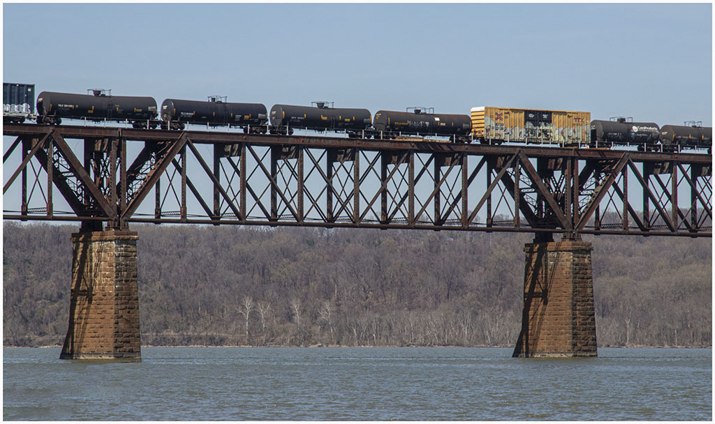
managed to catch one in flight. The trail along the river first went under an auto bridge for
the Pulaski Highway. It then went up almost to the railroad bridge that was active with
trains crossing. After the hike we drove around Havre de Grace and I took a couple of
pictures of murals on the sides of buildings that were part of a local history museum.
|

|
|
|
|

|
|
|
|
|
|
|
|
|
|
On Tuesday May 22 we drove up to Philadelphia to stay for two days. The description of our trip and photos can be seen by clicking here. |
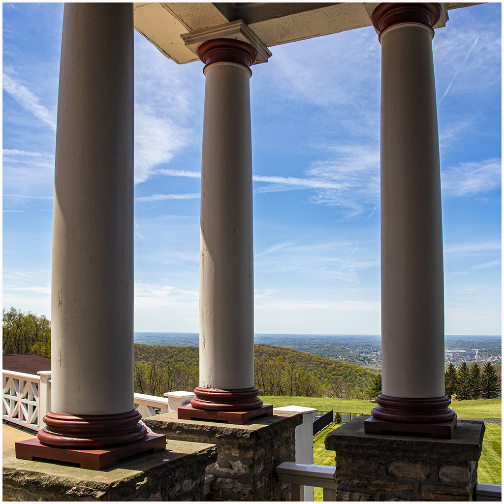
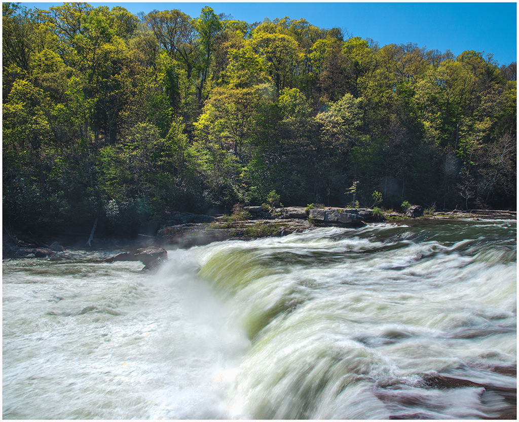
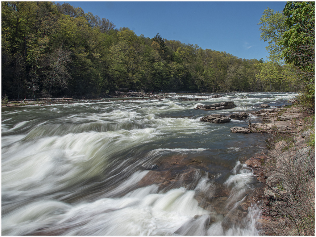
I was browsing google maps for interesting places to go for photography. I tried
"waterfalls in Pennsylvania" and came across Cucumber Falls that looked interesting
without being too difficult to reach by hike. It was a 3.5 hour drive to the
western part of the state so I looked for places to stay nearby and came across the
Historic Summit Inn just up the steep hill from Uniontown, Pennsylvania. We drove there
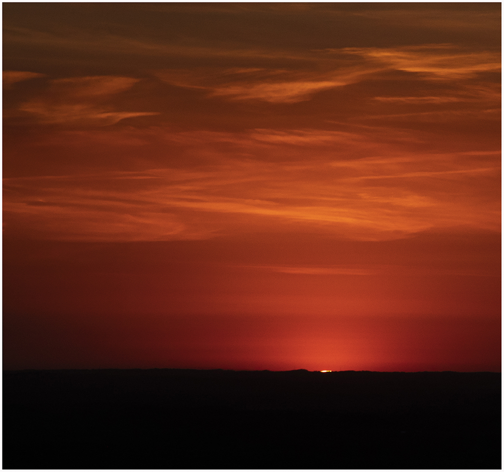
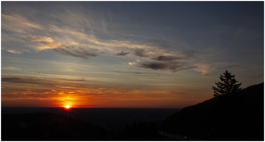
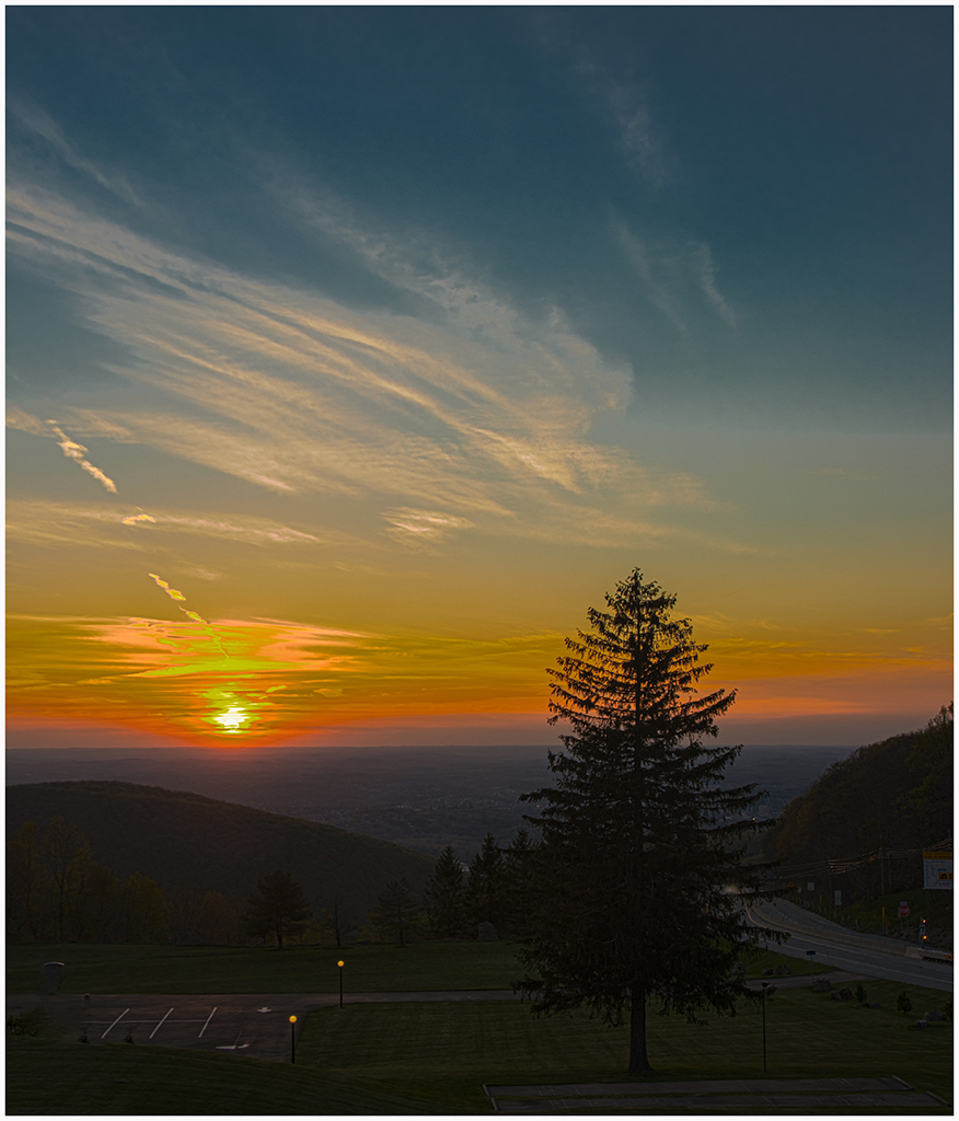
on Tuesday, May 10 and stayed for 2 nights. We drove the first afternoon to Cucumber
Falls located on a stream running into the Yougheqheny River. It was indeed easy to
get to a viewing point down a wide path. I got a couple of good pictures of the falls
but found that I simply couldn't make it all the way down the path to the stream bed
to get a different view. That evening we sat out on the patio of the hotel and watched
the sun set over the vista. I took a lot of pictures as we had quite a nice sunset
with lots of wispy clouds. |

|

|
|

|

|
|
|

|
|

|
|
|
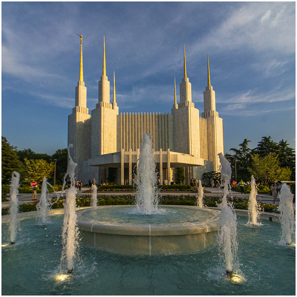
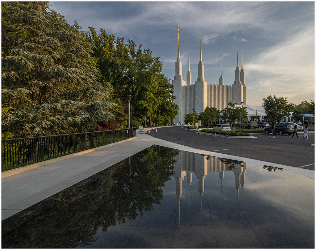
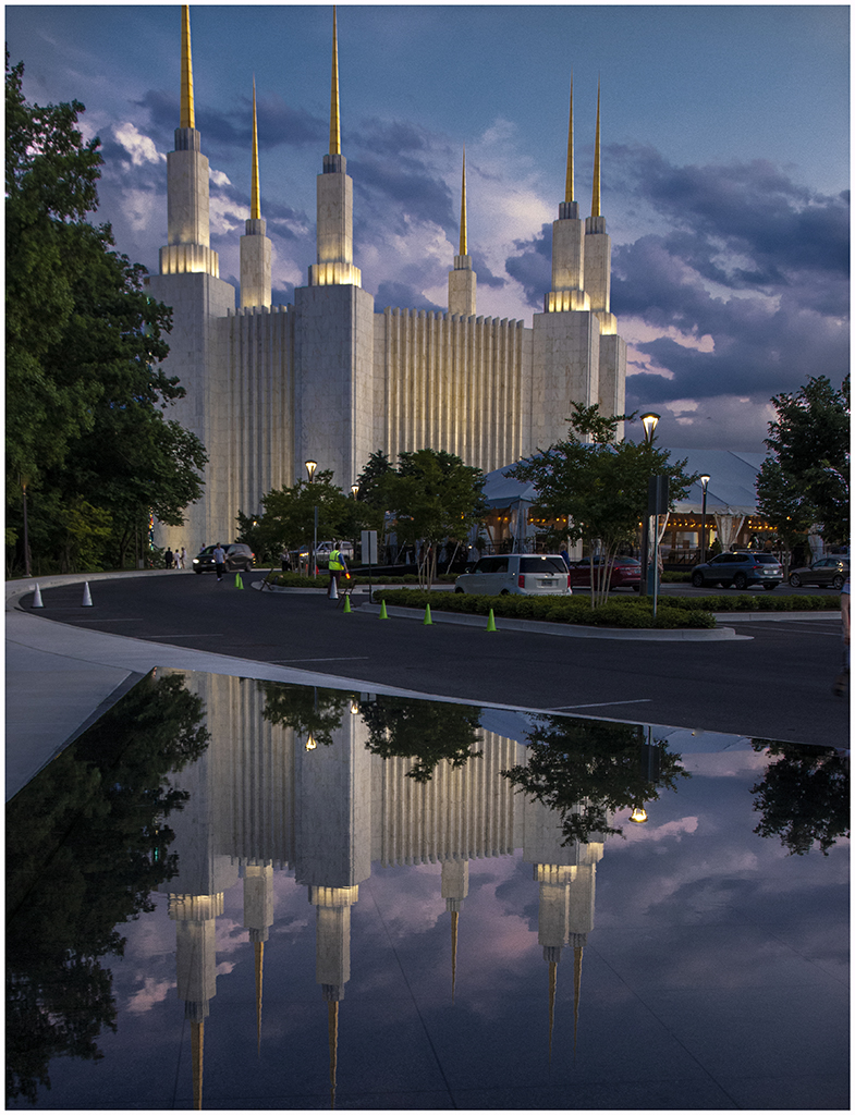
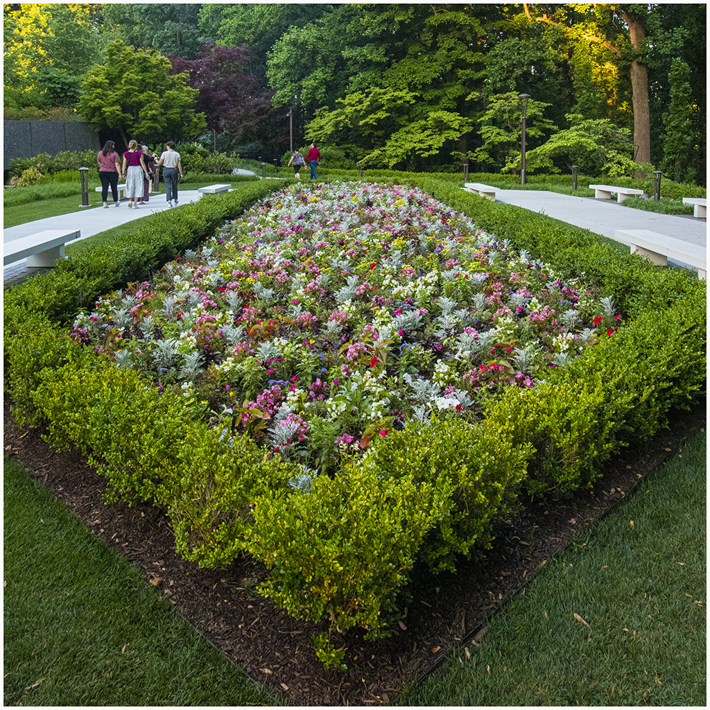
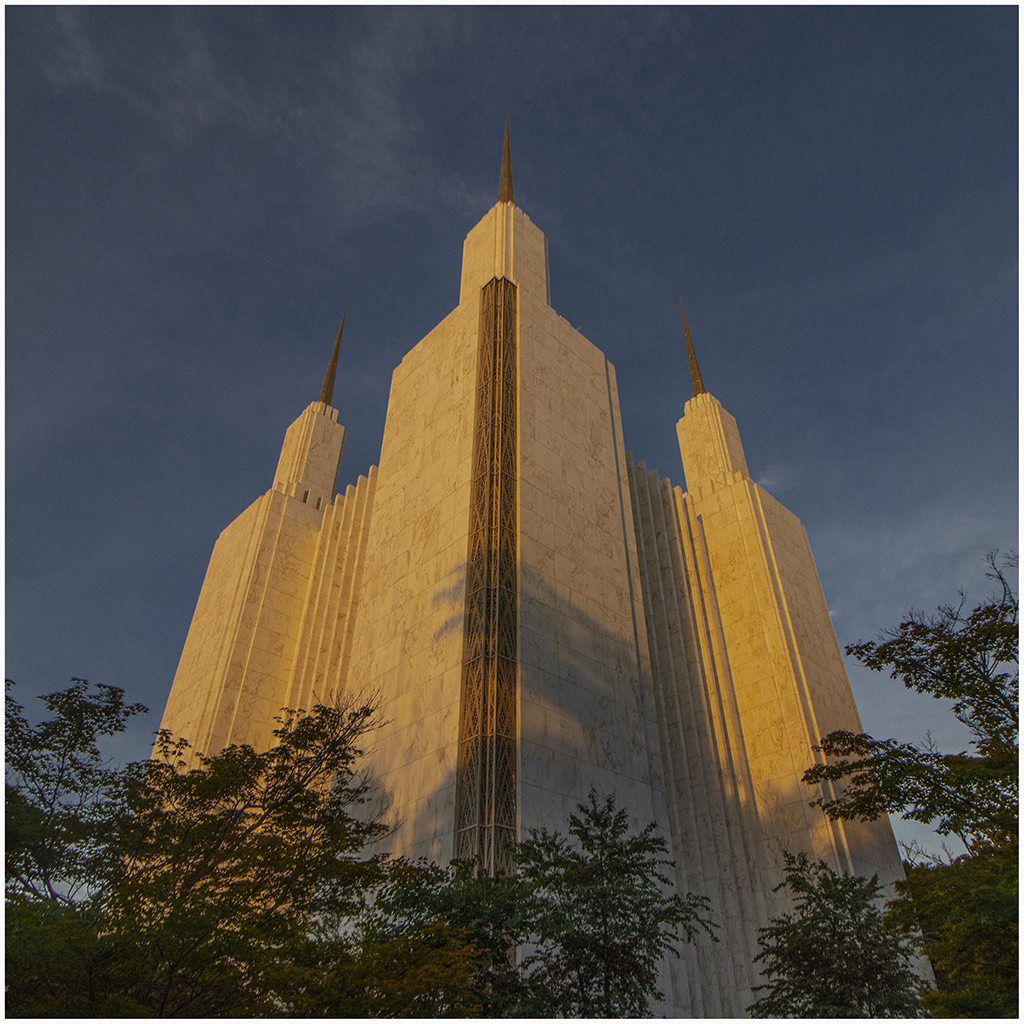
For several weeks in late May and early June the Mormon Temple held an open house and invited all to come and tour the temple and its grounds. The temple is a very noticeable landmark as one drives around the Washington Beltway between Georgia Avenue and Connecticuit Avenue, but neither of us had been to the actual grounds. You had to sign up for arriving at a specific time in order to control the parking availability. We chose Tuesday May 31 to arrive between 7:30 and 8:00 pm. The idea was to get pictures of the temple when the sun was getting low in the sky and then after the sun had set and the temple was lit up with artificial lights. The tour of the interior was a bit disappointing because we didn't really see the main area, only side rooms for meetings of various kinds (plus they didn't allow pictures inside anyway). The building and grounds are quite spectacular. I concentrated on 3 basic shots; one from a distance looking down the grassy mall between the trees leading to the temple; one up closer with the fountains in the foreground; and a third from over to one side where there is a shallow reflecting pool in front of their learning center. |

|
|
|
|
We decided to go back to the Mormon Temple to walk around the gardens and take a few more pictures. We went back on June 6 in the early evening and took the pictures below. |
|

|

|
|
Tuesday June 14 was the day of the "strawberry moon", a super-moon that would rise at 9:18 pm shortly after sunset. We drove down to the Annapolis city dock to observe. There were perhaps 50 people set up to observe with a guitar-playing singer; a sort of party atmosphere. The moonrise was not visible until about 9:25 when it could be seen above the buildings in Eastport. I set up my tripod and began to shoot, taking a picture exposed for the lights across Spa Creek in Eastport and then reducing the exposure to get some detail on the moon's surface. I was really not quite sure what was the best strategy. The first few were taken at ISO 2000 by mistake and then I switched to ISO 200. I tried a few exposures in between. When I got home I began to put them together in photoshop. I copied the moon from the low-exposure picture and superposed it on the other exposure. I found that it tended to have a bright ring around it because of the brightness near the rim of the moon on the low-exposure version. To fix this I simply increased the size of the superposed moon by a slight amount to cover the bright ring. There is probably a better way to do it, but I am not sure what that would be. Below are 3 pictures that I came up with. |

|

|

|
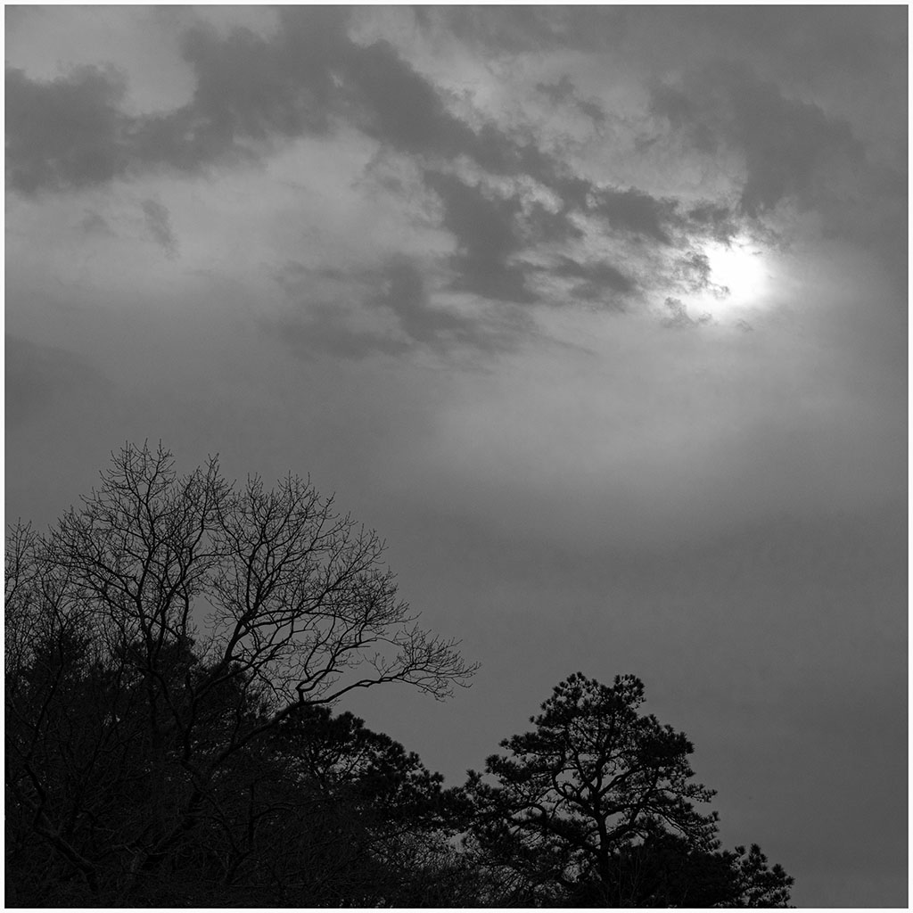
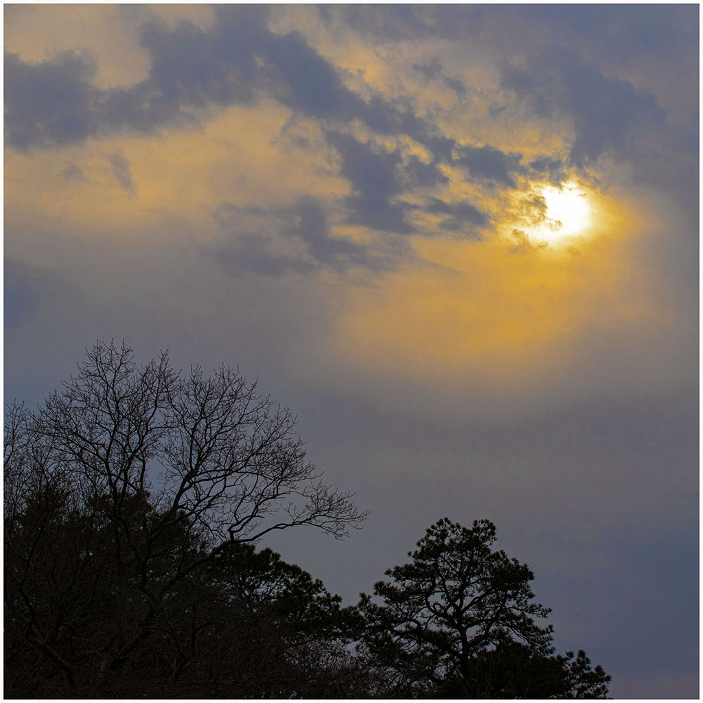
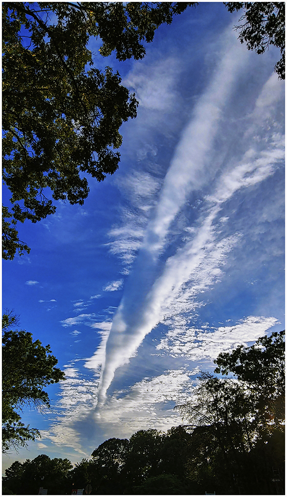
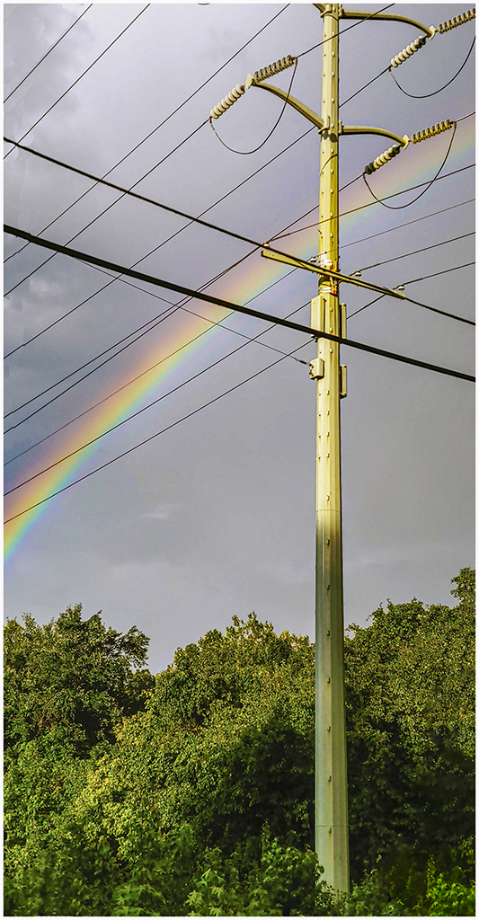
On Tuesday June 28 we took a short walk in Crofton. I noticed an unusual cloud formation and took this picture with my phone. |
|
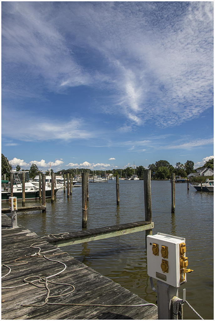
Wow it is now Sunday August 14 and we are finally getting out with my camera. After a series of problems with my back it was determined that the latest cancer trial was not working and the lesion on my back was growing so I had back surgery to brace several vertebrae so that I could have radiation therapy to destroy (hopefully) the cancerous cells. We don't yet know the specific results but I am now finished with the radiation (as of Monday the 15th). We took a drive on Sunday to Shadyside, got a BBQ sandwich to eat in the car at a park and then drove to a boatyard where I took one picture and along the water for another picture of a dock. I am still very limited in walking but was happy to get these two pictures. |
|

|
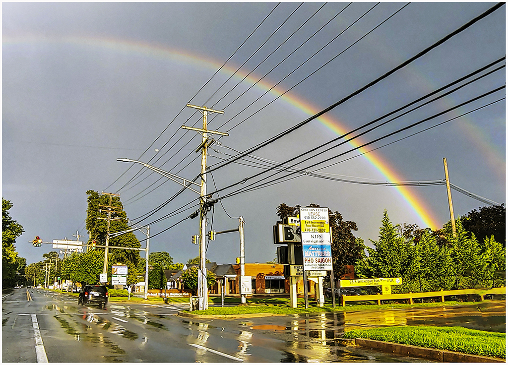
On Wednesday, August 17 we took our takeout dinner to Allen Pond Park in Bowie to eat in our car while a storm was passing. Driving home the storm was all around us but the sun came out and we saw a very bright rainbow. Shirley was driving and I had my window rolled down desparately trying to use my phone to get pictures as we headed toward home. The pictures below are the best that I managed to get. |
|

|
|
It is Friday September 9 and we are now in the last day before I begin a new chemotherapy
to treat my prostate cancer. After an extended period of focusing on my back with surgery and
radiation we will now restart attacking the overall cancer in my body. Before beginning
this new therapy we decided on a short trip by auto to the Eastern Shore of Maryland. The
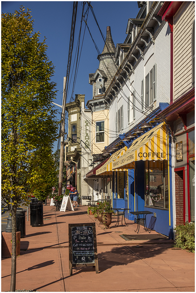
idea was to begin focusing on some of the small towns in Maryland and the interesting
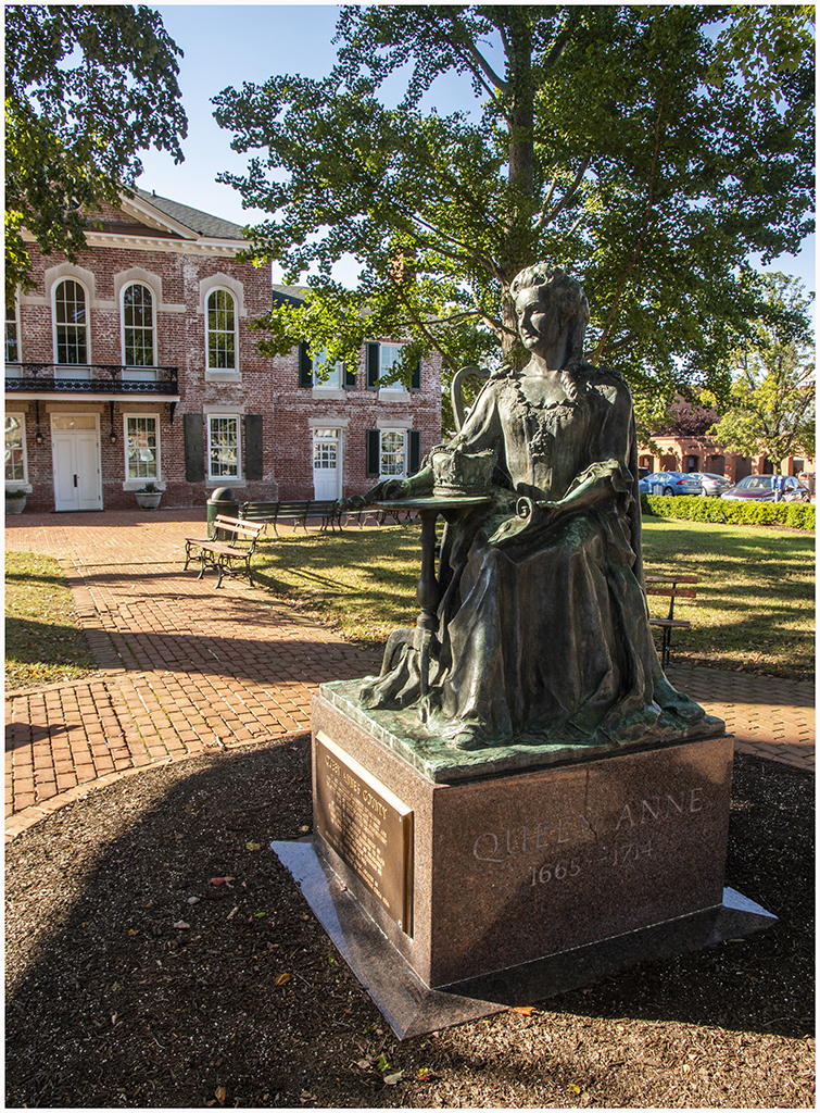
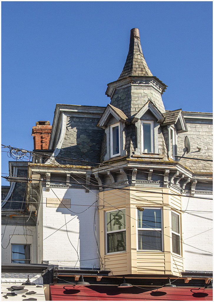
architecture of their old buildings. So we headed towards Chestertown. On the way we
stopped in Centreville where we got out of the car and walked around the town square. |
|
|
|

|
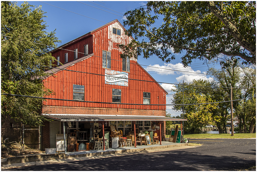
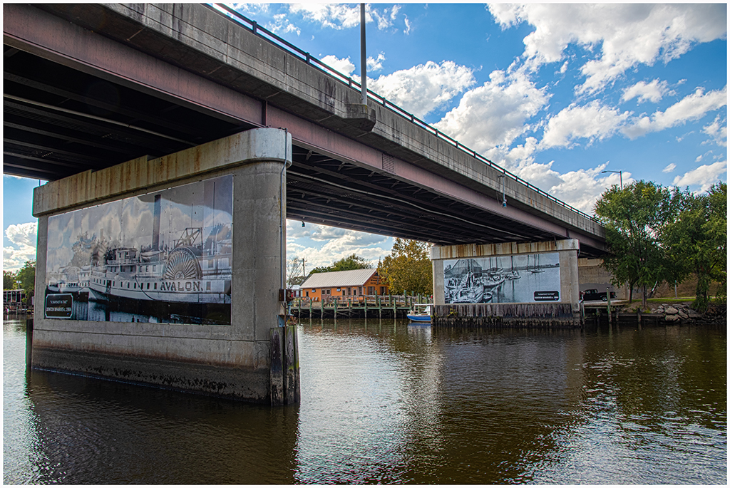
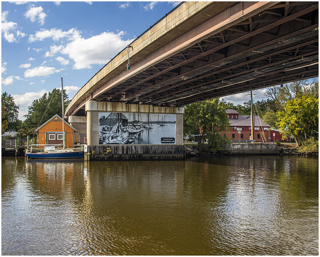
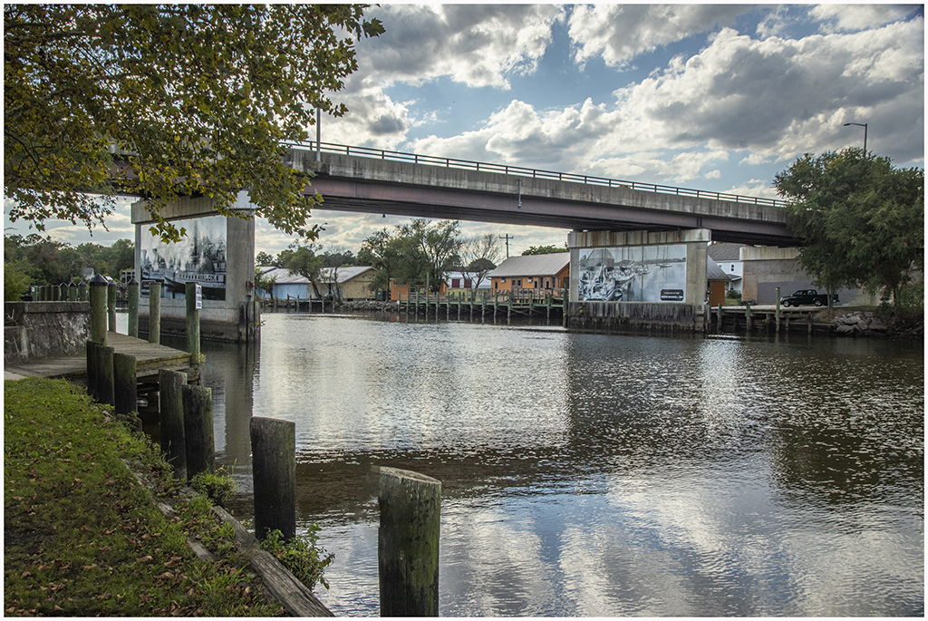
On Tuesday September 27 I had just had my second chemo infusion delayed by a week to allow me better recovery from the first infusion. So I was beginning to feel more energy. We decided to drive to the Eastern Shore and chose the town of Denton to explore. We drove around town a bit and then stopped to get fast food sandwiches that we took to Crouse Park in town on the Choptank River. The piles of the bridge across the Choptank had interesting murals. I took several pictures from the park and also across the river. |
|
|
|

|
|
On Wednesday September 28 we decided to drive to Sykesville to take a few pictures and stop for ice cream. I did get a couple of pictures but my back started hurting, which kept me incapacitated for more than a week. |
|
|
On Thursday October 6 I went for my second session of chemo late in the afternoon. On the way home we were treated to a gorgeous sunset. Shirley was driving and I got a couple of pictures from the car using my phone. One is just the sunset while the other is the bridge on I-895 that goes over the railroad tracks just south of the tunnel. |

|

|
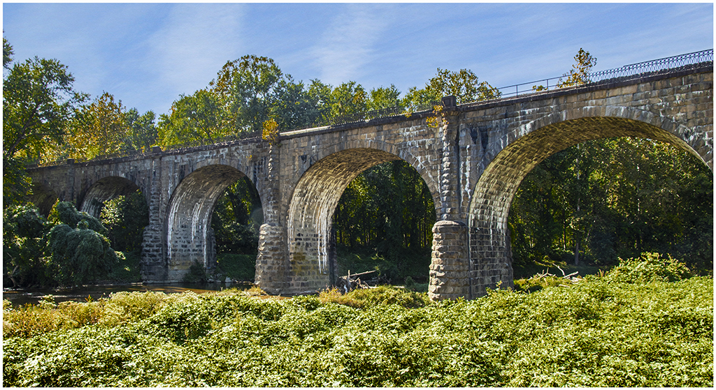
On Friday October 7 we picked up a takeout lunch and headed to the Avalon area of the Patapsco Valley State Park. As we were leaving we stopped near the exit and I walked a short way through the field to get this picture of the Thomas Viaduct. That short walk was at the limit for my sore back. |
|
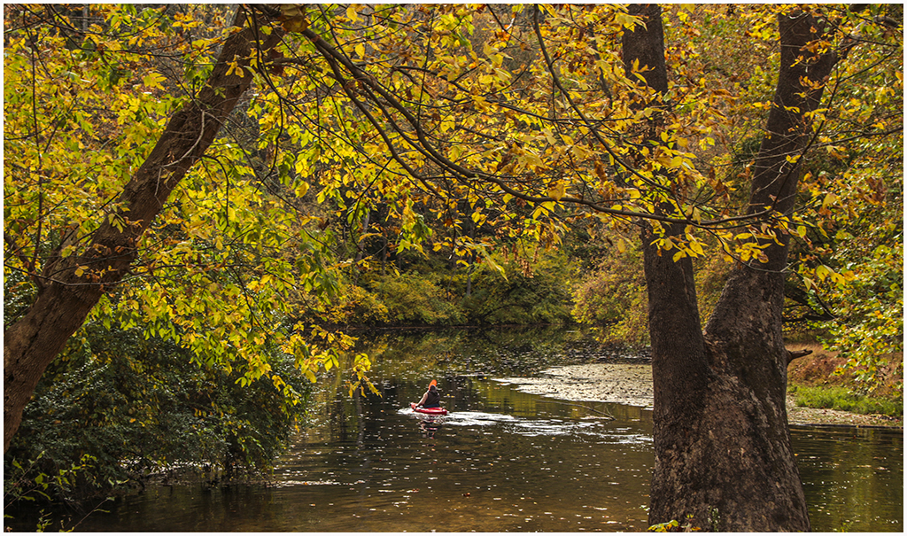
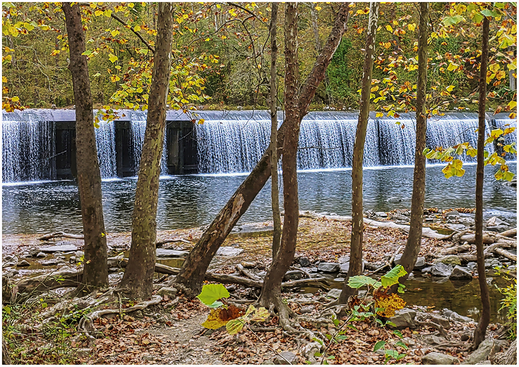
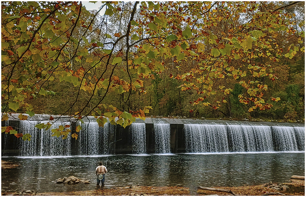
On Sunday October 16 we drove to the Daniels Area of Patapsco Valley State Park. We picked up a sandwich for lunch on the way and ate it at one of the parking lots overlooking the lake behind the Daniels Dam. We then drove down the road a little way to reach the dam. I attempted to walk down the short path to take pictures of the spillway and the fisherman, but my balance was wobbly and I didn't trust myself on this very short path. Shirley took my phone down and took the pictures of the dam and the fishermen. |
|
|

|
|
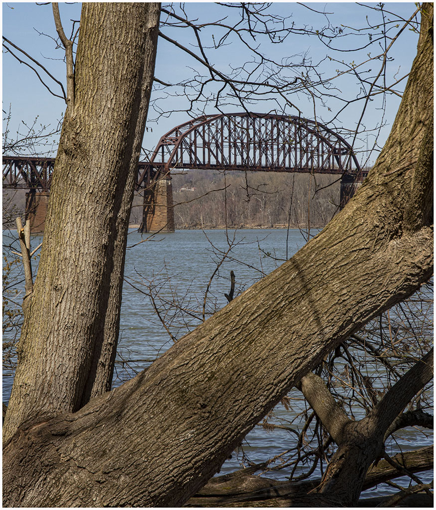
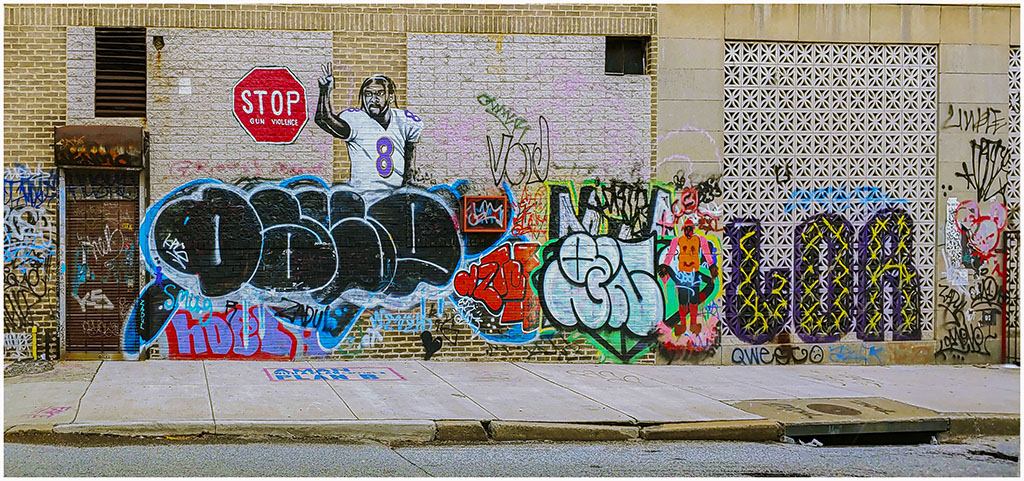
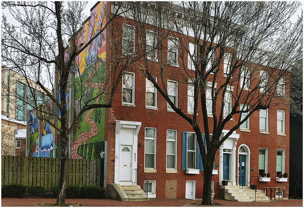
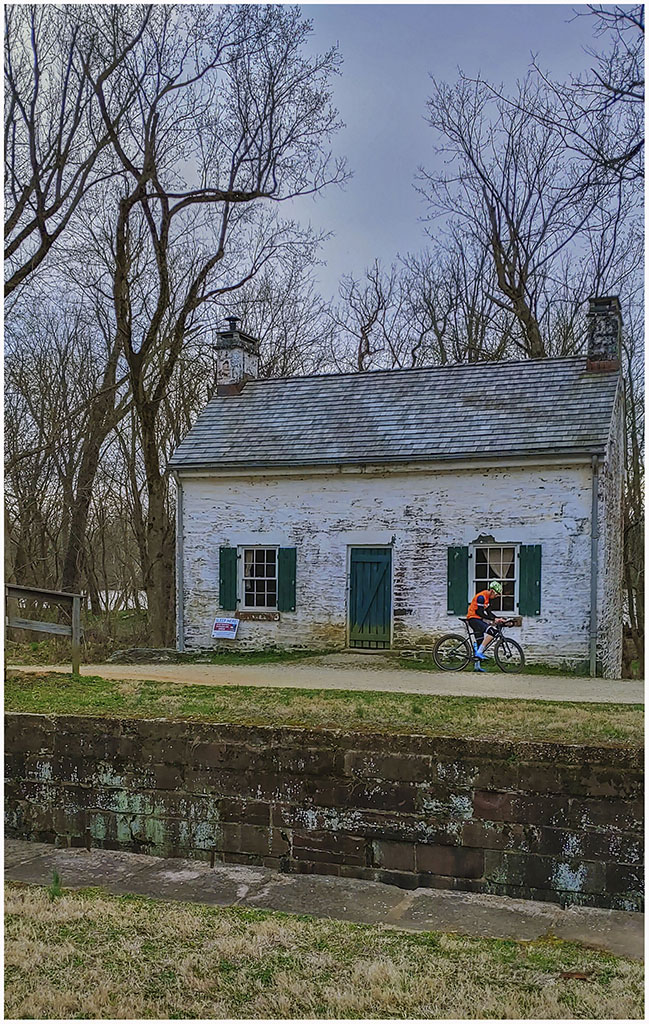
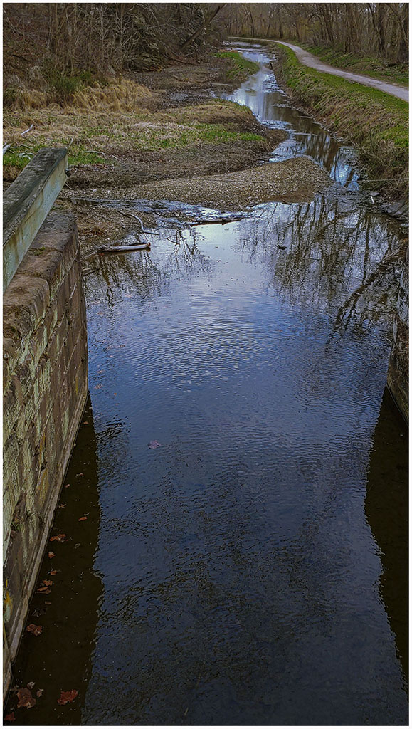
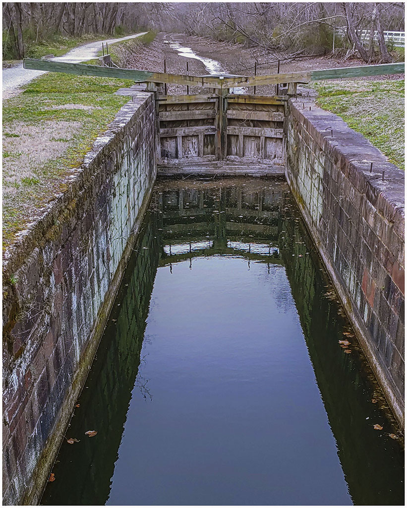
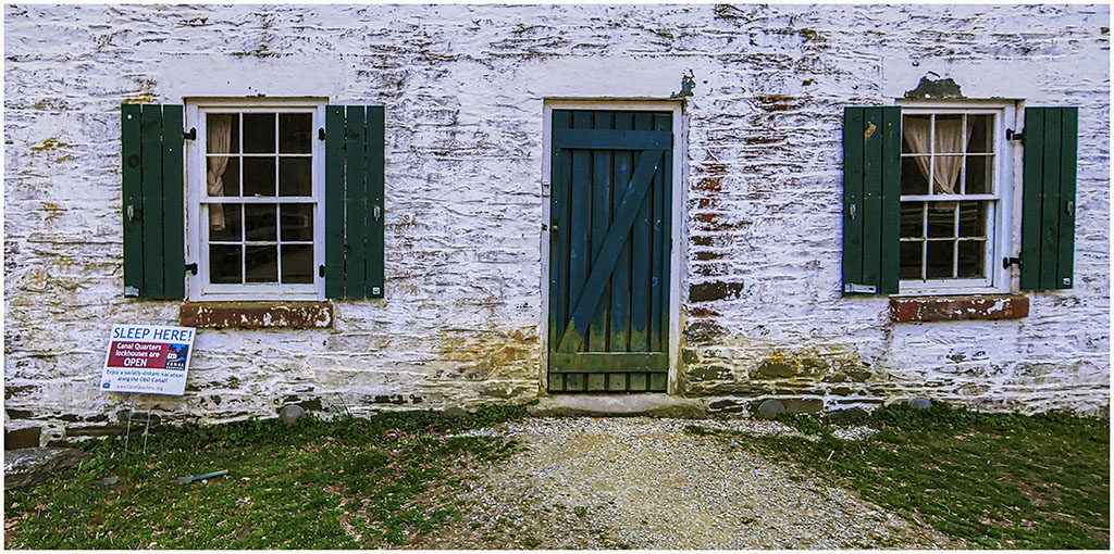
While looking over old photos on my phone, I found several taken in March that I had neglected to put on this blog. The first 2 were taken in Baltimore on March 18, one of a wall mural and the other of a building with a mural on the side. I am not sure what we were doing in Baltimore on that day. The next group of pictures come from Lock 22 on the C&O canal going up the Potomac River taken on March 20. The lock had an interesting old building that apparently you could rent for an overnight stay. |
|
|
|
|
|
|

|
|
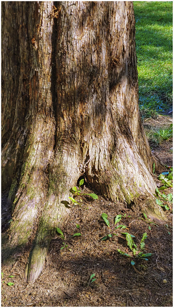
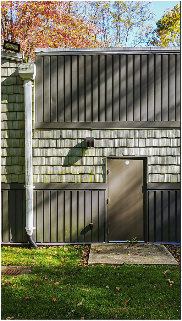
On October 18 we picked up a takeout lunch and went to Whitemarsh Park where I took the two photos below; one of a tree trunk and the other of the back door to the Bowie Playhouse. |
|
|
On October 27 I had another chemo infusion and took the picture of the hospital below from the window of the Virah building. |
|
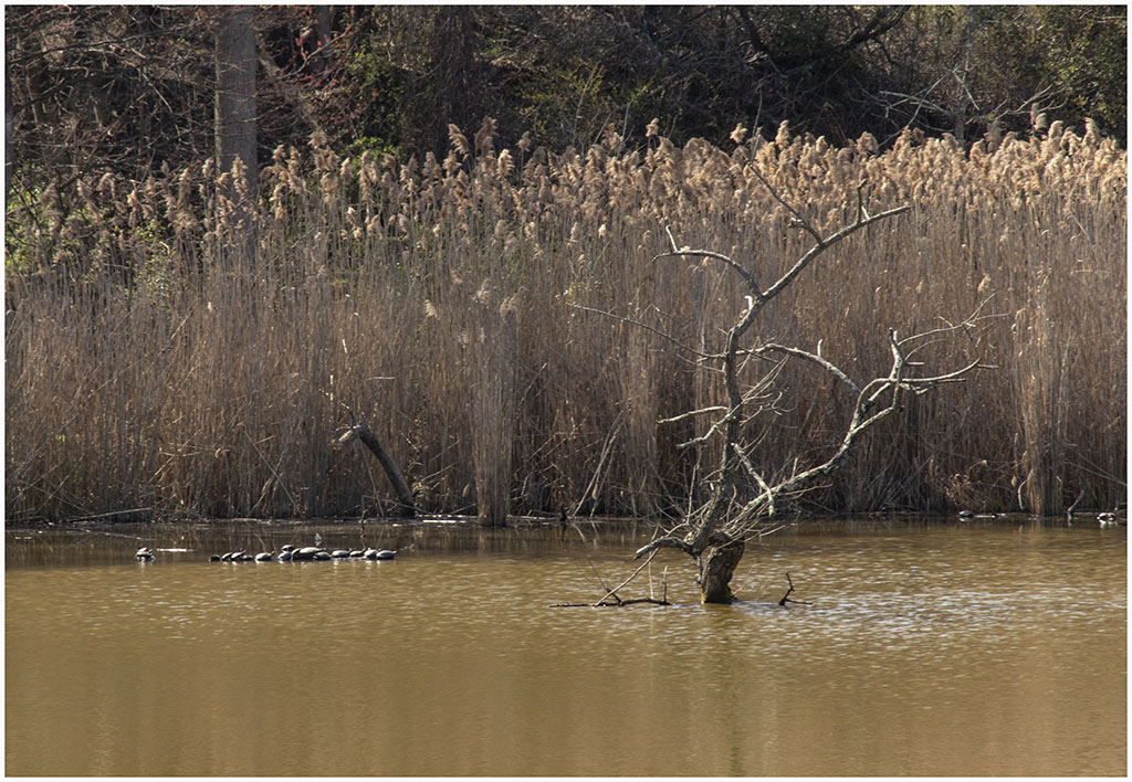
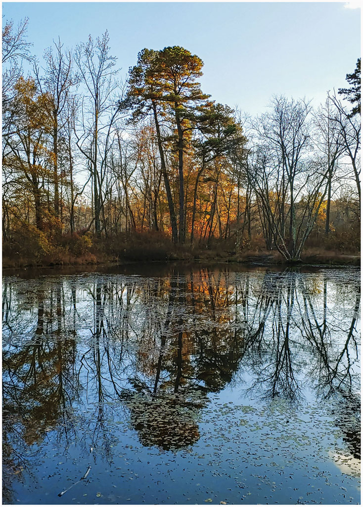
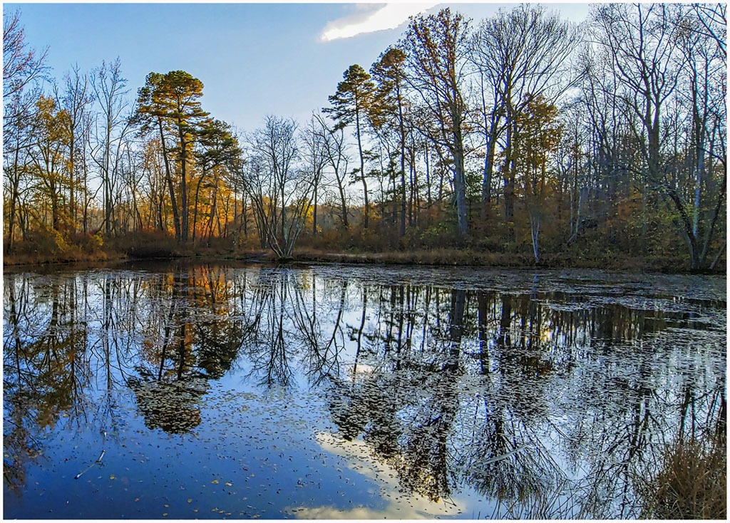
On November 1 we picked up a takeout lunch and went to Patuxent Ponds Park near Woodwardville. I took these pictures of the pond with remaining leaves on the trees. |
|
|
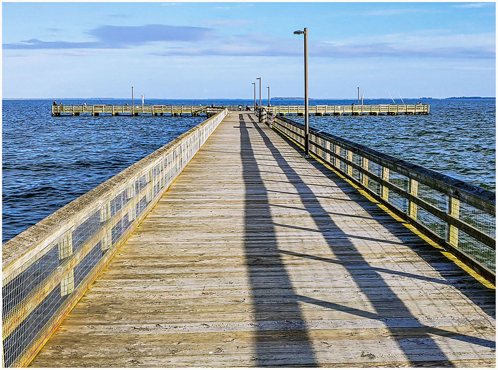
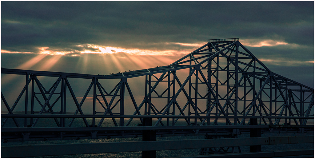
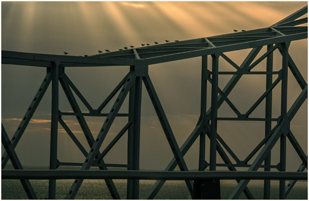
On November 10 we took a short drive to the Eastern Shore and headed south on Kent Island to Romancoke. We stopped at the Romancoke fishing pier and took a couple of photos on the way. On the way back Shirley drove and I took some pictures as we crossed the Bay Bridge with darkening skies and the sun's rays coming through the clouds. |
|
|

|
|
|

|
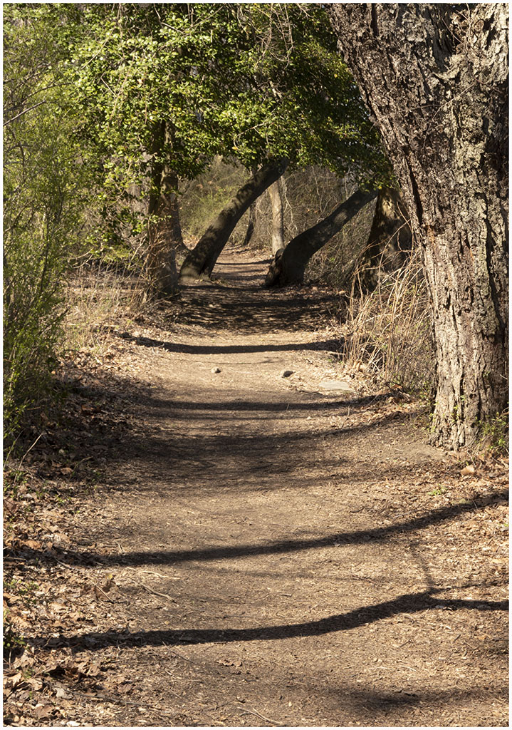
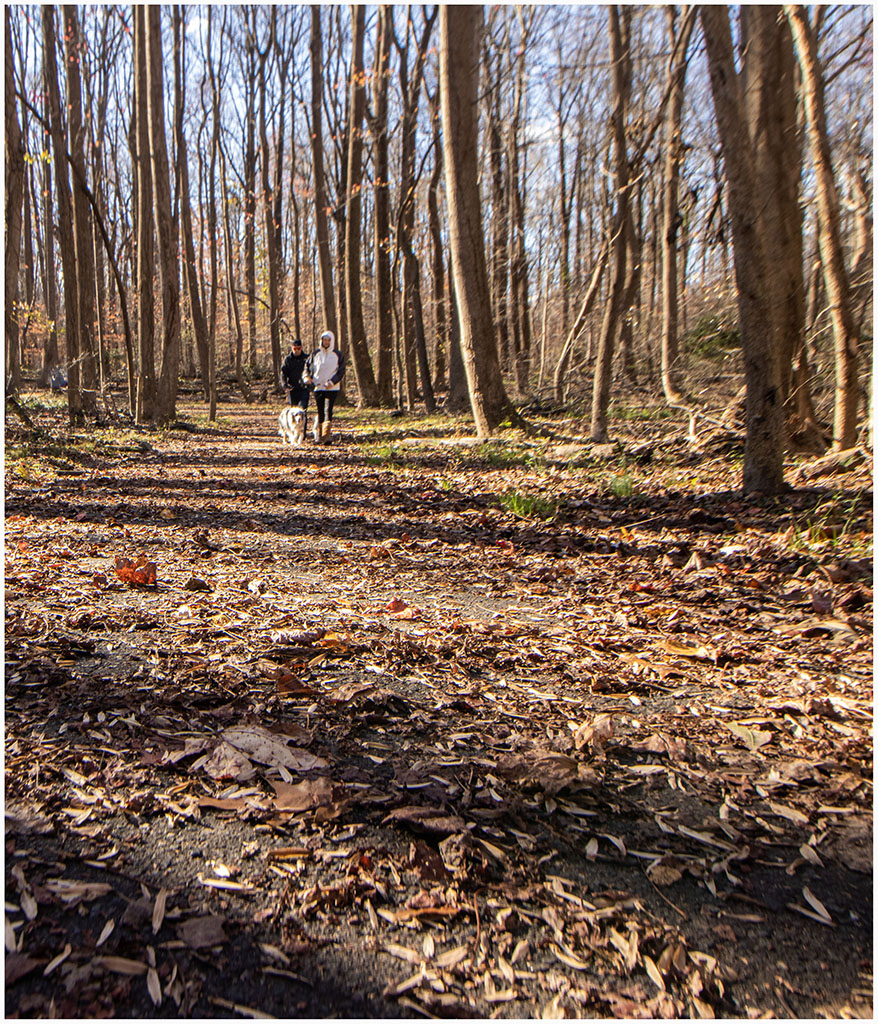
We've not been very active in going places as my chemo had more than usual side effects, but we did get to Whitemarsh Park where we ate lunch in the car and took a short walk slong the path shown in the picture below. |
|
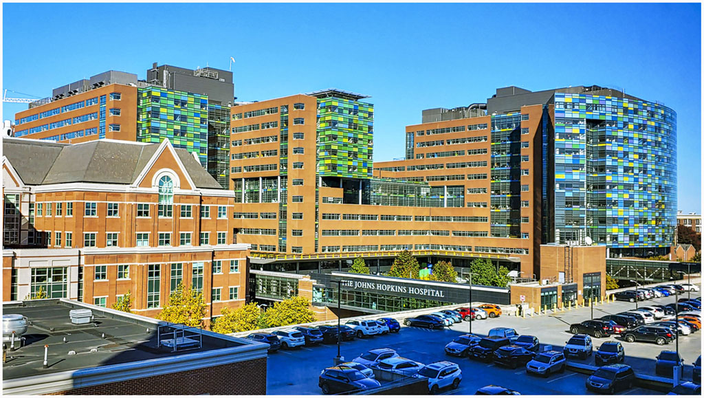
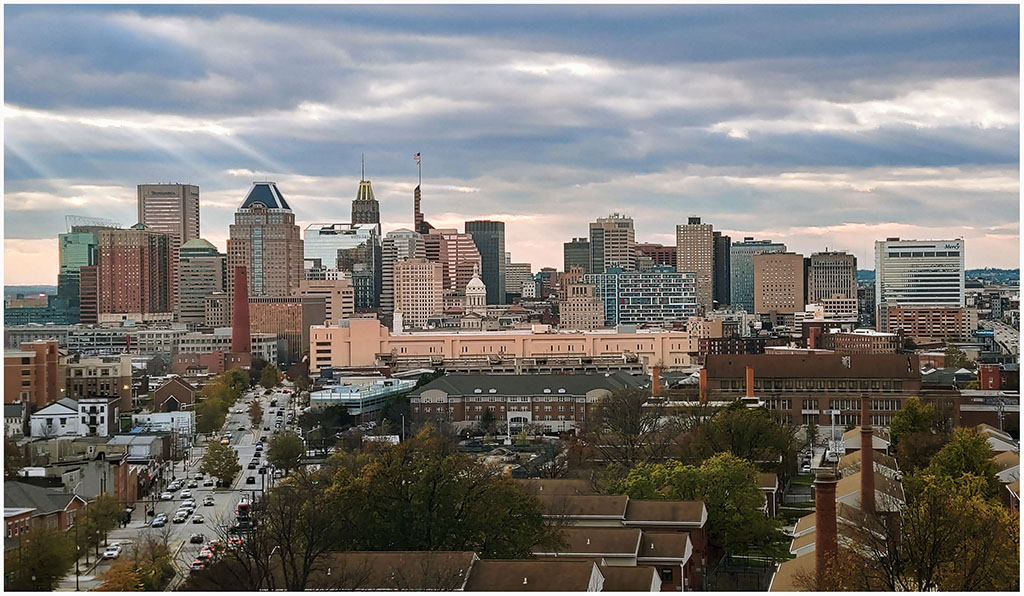
I had my fourth chemo infusion on November 17 and seem to be having less side effects with an 80% dosage. Below is the picture of Baltimore that I have taken many times from the Johns Hopkins hospital. |
|
I went in for my 5th chemo infusion on December 8 but was informed that the bone scan indicated that the cancer had spread and the chemo was not effective. My CT scan showed no soft tissue cancer and I was sent to a radiation oncologist a week later who determined that I was a good candidate for a radium-223 treatment. The radium-223 acts like calcium and goes straight to the bones where the alpha radiation tends to preferentially kill rapidly growing (i.e. cander) cells. So we scheduled a treatment for January 4, 2023. I got to take a few weeks off of treatments and enjoy Christmas with the family. |